
Sign up and Getting Started
Spatial Desktop requires a Foursquare account to access your geospatial projects and synchronize your workspace. If you already have a Foursquare account, you can use your existing credentials to sign in. If you do not have an account, you can create one during the sign-in process using your email address, Google account, or Foursquare account.
-
Start up the app, Select Sign in

-
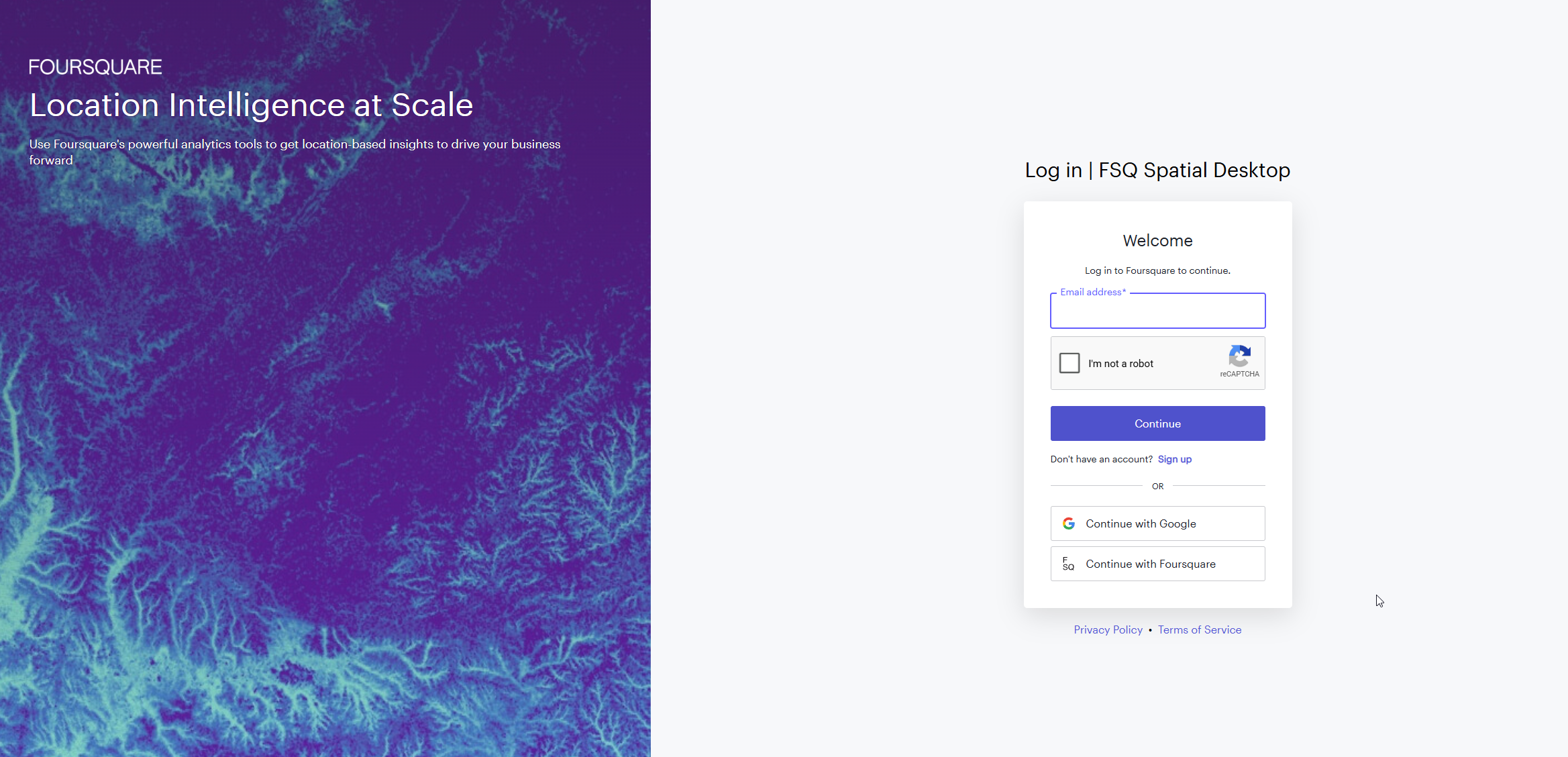
Your web browser will open. Sign in or create an account using your email address, Google account, or Foursquare account.
-
After signing in, you will prompted to open FSQ Spatial Desktop. Click Open FSQ Spatial Desktop

-
First-time users will be prompted to review and accept the Terms of Service.

-
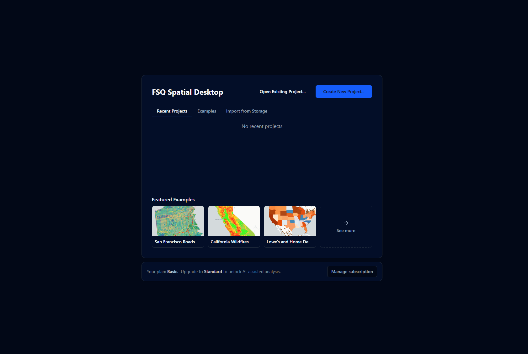
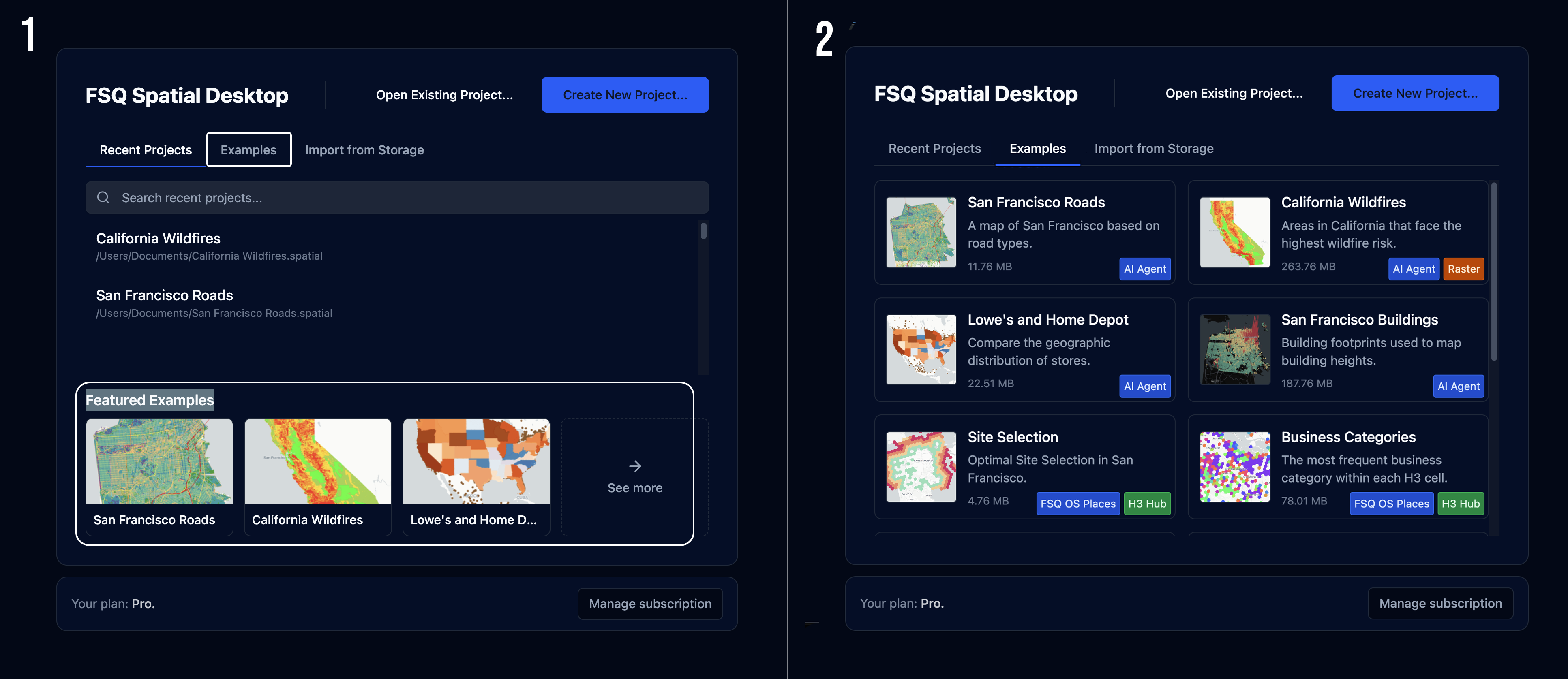
After signing in, the Spatial Desktop start screen will appear. From here, you can create a new project, open an existing project, load an example project, or import a project from cloud storage.
Projects
FSQ Spatial Desktop organizes your work into projects. A project contains your datasets, queries, maps, visualizations, and workspace configuration in a single portable .spatial file.
Create a New Project
To start a new analysis project:
-
Open FSQ Spatial Desktop from your Applications folder.
-
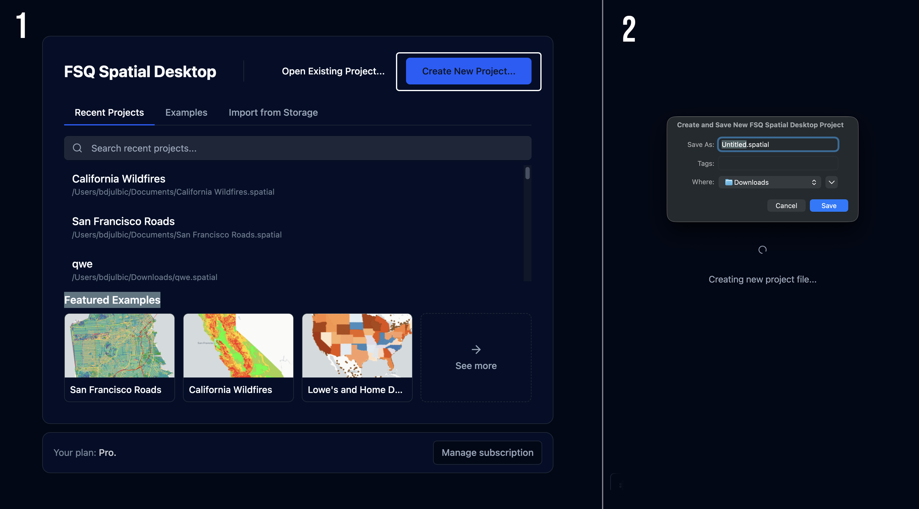
On the welcome screen, click Create New Project...
-
In the Create and Save New FSQ Spatial Project dialog:
- Enter a project name in the Save As field (for example,
demo_spatial) - Choose the location where the project should be saved
- Enter a project name in the Save As field (for example,
-
Click Save
FSQ Spatial Desktop will initialize a new local database for the project.
Open an Existing Project
To continue working on an existing project:
-
Launch FSQ Spatial Desktop.
-
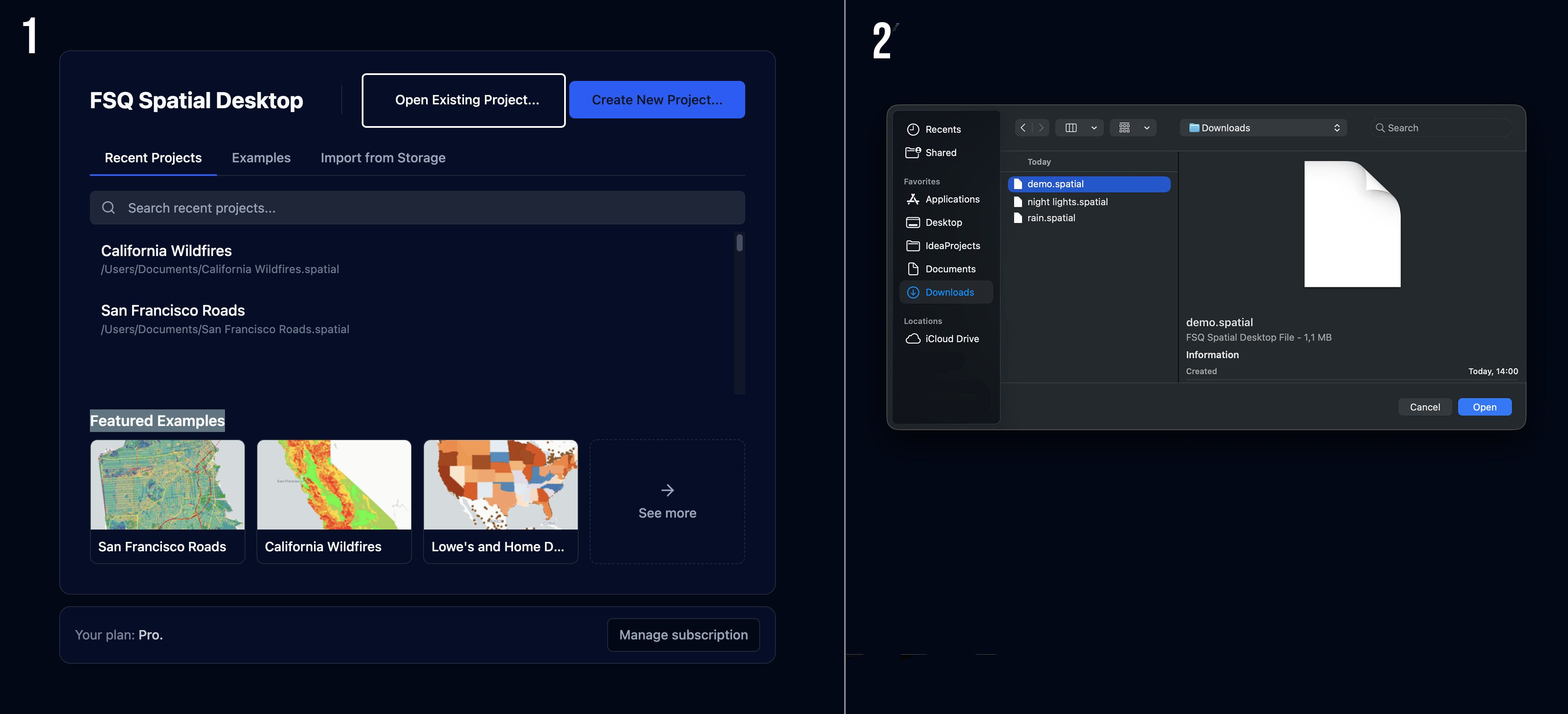
From the welcome screen:
- Select an existing project from the recent projects list, or
- Click Open Project...
-
Browse to your
.spatialproject file and open it.
The project, including datasets, maps, and queries, will be restored automatically.
Load example projects
You can open example projects in two ways:
1. Click the Examples tab at the top of the welcome screen.
2. Select one of the Featured Examples shown at the bottom of the Recent Projects tab.
The examples demonstrate different spatial analysis and visualization workflows, including:
1. San Francisco Roads — Visualizes San Francisco road networks and road classifications.
2. California Wildfires — Shows wildfire risk and hazard zones across California.
3. Business Categories — The most frequent business category within each H3 cell in USA....
Save a Project
Projects are automatically saved while you work. All imported datasets, queries, map layers, and workspace settings are stored inside the project database.
To create a separate copy of a project, use Menu → File → Save As
This creates a new .spatial project file at the selected location.
Updated about 9 hours ago