Import Data
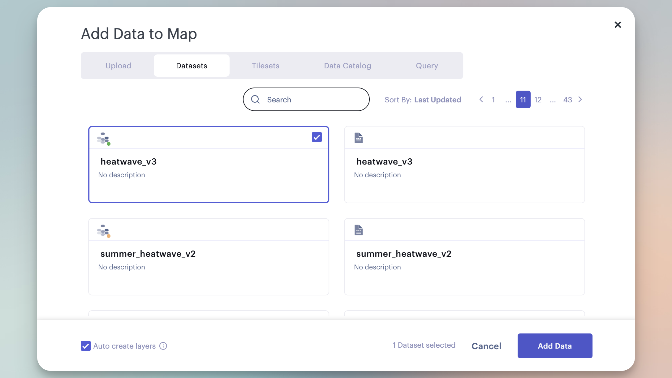
When you create a new map, the Add Data to Map window appears.
To reopen the Add Data to Map window during your Studio session, click the + Add Data button.

The Add Data modal.
When data is added to the map, by default Studio attempts to automatically recognize and create new layers.
Import Tabular Datasets
Tabular datasets (or datasets) contain rows and columns serving as the primary source for data analysis in Studio.
To import new datasets, follow these steps:
- In the Add Data to Map window, navigate to the Upload tab.
- Click Browse, drag and drop, or enter a valid URL to import your datasets.
- Click Add Data to complete the import.
All uploaded datasets will appear in the Data tab on the dashboard, where you can manage your datasets.
Learn more about adding data to a map in Studio.
Import Tiled Datasets
Tiled datasets (or tilesets) contain image files that represent real-world phenomena on your map. Studio can display:
- Raster tiles, which contain pixel-based imagery stored in a grid structure.
- Vector tiles, which contain vector-based imagery such as points, lines, and polygons.

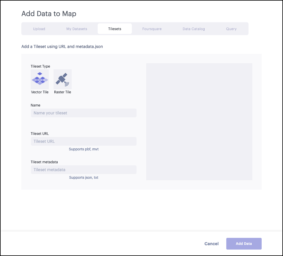
Adding a new tileset to Studio.
Studio allows you to work with tiled datasets from several formats, including Vector tiles, Cloud Optimized GeoTIFFs (COG), and other supported data formats.
To import new tiled datasets, follow these steps:
- In the Add Data to Map window, navigate to the Tilesets tab.
- Select your tiled dataset's type by clicking Vector Tile or Raster Tile.
- Enter a name for your tileset, or leave the field blank to automatically name it.
- Enter a URL pointing to your tileset.
- Click Add Data to complete the import.
Learn more about importing tiled datasets.
Auto Create Layers
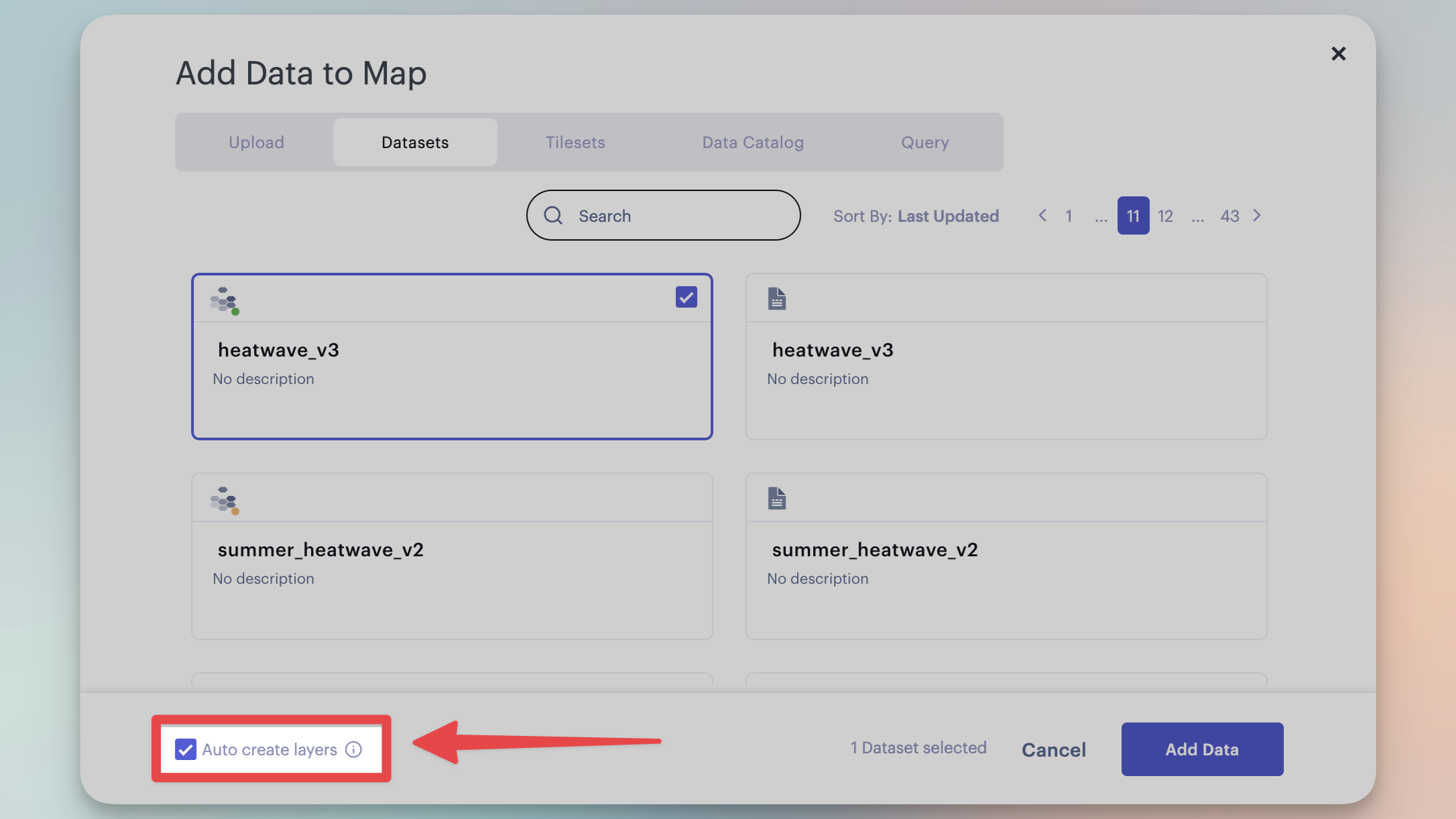
Studio will automatically detect layers, searching for column names in your CSV file that follow standard naming conventions. This operation is enabled by default, but can be disabled by unchecking the Auto create layers checkbox at the bottom of the modal.

Auto create layers checkbox.
Auto create layers detects several types of data, most of which relating to established spatial identifiers, such as:
latandlngpoints, which automatically create a Point layer_geojsoncolumns which automatically generate a Polygon layer- Well-known US administrative boundaries (such as ZIP codes or census tracts), created via Shapify
Note:Studio recognizes a variety of column names and data types. For instance,
lng,long,lon, andlongitudewill all be detected as a longitude column. If your data is not being automatically recognized, ensure your columns are named appropriately!
Updated 7 days ago
