
Polygon Layer
Polygon Layer can display GeoJSON features. GeoJSON supports the following geometry types: Point, LineString, Polygon, MultiPoint, MultiLineString, MultiPolygon.
A polygon GeoJSON layer is essentially a choropleth layer and works best for rendering geofences. Fill color or height can be set with a numerical field. For example, it can display population by census tracts.
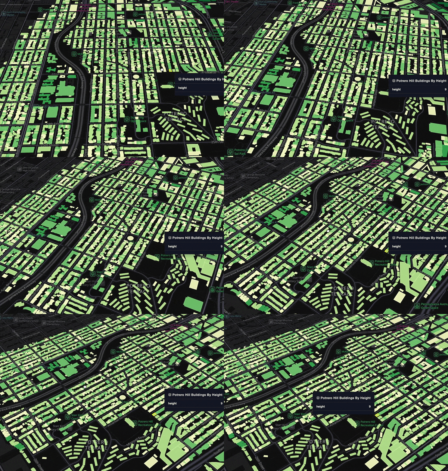
Settings
The follow sections detail every setting available in the Polygon Layer.
Basic
Core settings for the Polygon Layer.
| Setting | Description |
|---|---|
| Layer Type | Must be Polygon to use the Polygon Layer. |
| Dataset | The dataset to use for the Polygon Layer. |
| Columns | The column(s) containing polygon data. |
| GeoJSON | A GeoJSON FeatureCollection to use for polygon generation. See above. |
| Table columns | Tabular input used for polygon generation. See above. |
Fill Color
Settings related to the fill color of the polygons.
| Setting | Description |
|---|---|
| Fill Color Toggle | Toggle on/off to show/hide fill color. |
| Color Based On | The field to base the fill color on. |
| Color Scale | The color scale and palette for the fill color. |
| Opacity | The opacity of the fill color. 100 = fully opaque, 0 = fully transparent. |
Stroke Color
Settings related to the stroke color of the polygons.
| Setting | Description |
|---|---|
| Stroke Toggle | Toggle on/off to show/hide stroke. |
| Stroke Color Based On | The field to base the stroke color on. |
| Stroke Color Scale | The color scale and palette for the stroke color. |
Stroke Width
Settings related to the stroke widths of the polygons.
| Setting | Description |
|---|---|
| Stroke Width | The stroke width in pixels. When based on a column, define a range instead of a static width. |
| Stroke Width Based On | A field to base stroke width on. |
Height
Height settings for the polygon layer. Height is best viewed with the 3D viewing mode.
| Setting | Description |
|---|---|
| Height Slider | Increase to raise the height of the layer's polygon. |
| Height Based On | An column to base the height off of. |
| Height Scale | Choose from linear, sqrt, and log. |
| Fixed Height | Applies height without additional modifications. |
| Shows Wireframe | Show the wireframes that define the polygon. |
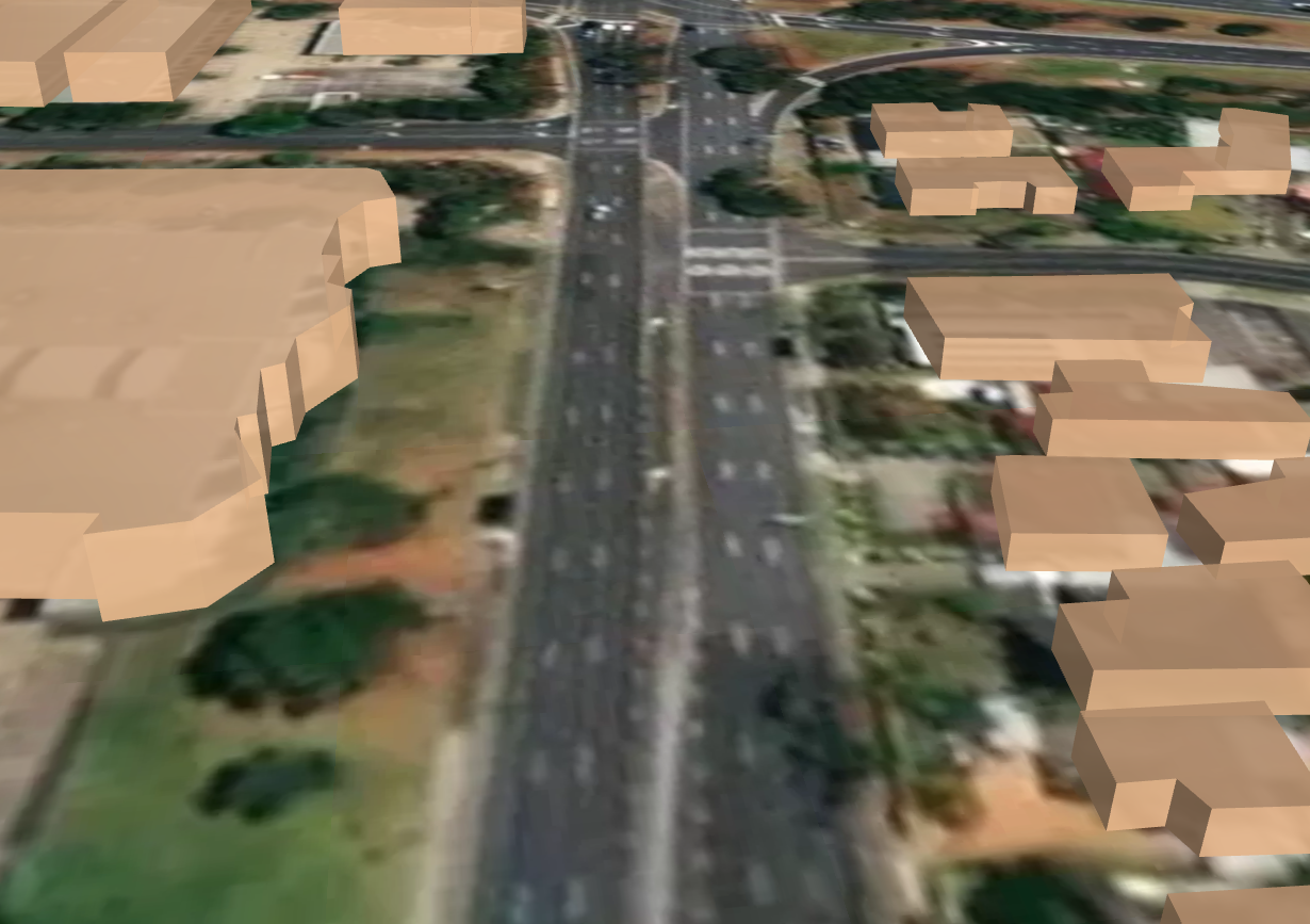
Polygon Layer visualizing building footprints with fixed heights.
Label
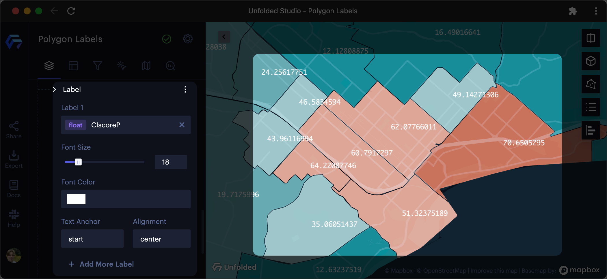
Label settings for the Polygon Layer. Labels are attached to each polygon.
| Setting | Description |
|---|---|
| Label Field | Select a field to display on the label. |
| Font Size | The size of the font to use on the label. |
| Font Color | The color of the label font. |
| Outline Width | The width of the outline in pixels. Set to 0 to disable the outline. |
| Outline Color | The color for the outline label. |
| Background Color | Toggle to enable a background color for the label. Choose a color with the color selector. |
| Text Anchor | Where, relative to the polygons, to anchor the text. Choose from start, middle, or end. |
| Alignment | How to align the text. Choose from top, middle, or bottom. |
| Add another label to the polygons. |
Updated about 4 hours ago